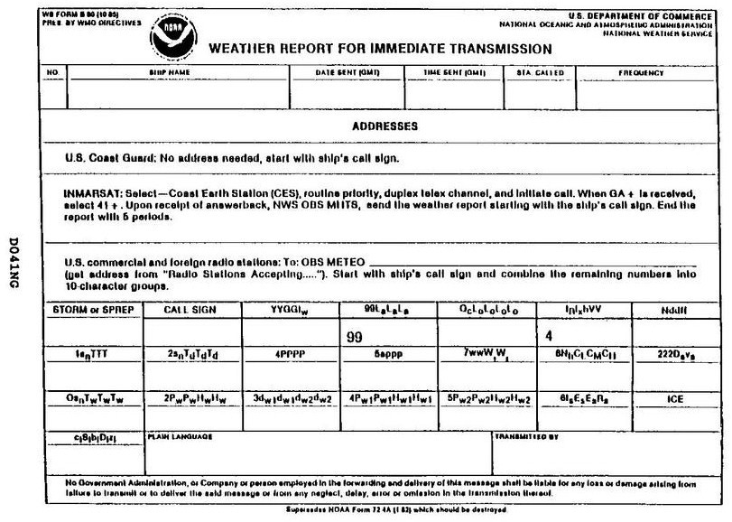
Your vessel is participating in the Voluntary Observing Ship Program, you are preparing WS Form B-80 as seen in illustration D041NG below. Your position is LAT 64°42'N, LONG 02°28'W. How would this be encoded?
Official USCG Answer & Rule Citation
Correct Answer: Option B — 99647, 70025
In the WMO FM 13-XII SHIP code, the position group 99LaLaLa LoLoLoLoLo uses a quadrant indicator (Qc). For 64°42'N, 02°28'W, the quadrant is 7 (North/West). The latitude is 647 (64.7°) and longitude is 0025 (02.5°). Thus, the encoded groups are 99647 and 70025, following standard meteorological reporting formats.
100% Free & Open Access — No daily limits, paywalls, or gated answers on BrightMariner.